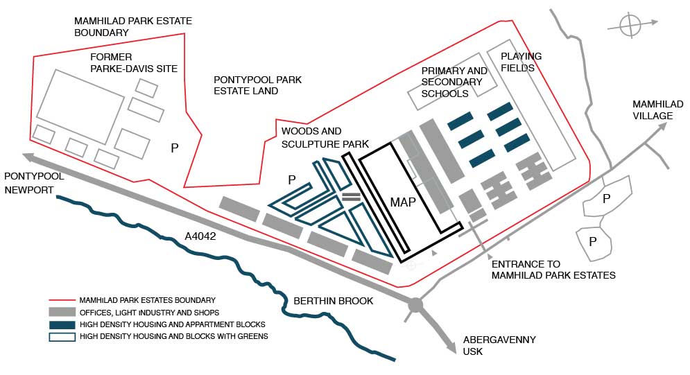
MAP firmly believe that the surrounding land, which includes the administration buildings and the former Parke-Davis site (designed by Ivan Dale Owen, 1969), ought to be included in the master plan. It would permit the creation of an architect-researched, sustainably designed C21st housing site, a school (as required by Torfaen’s Local Development Plan), apartment buildings aligned with the existing administration buildings and terraced housing opposite the long elevation, in a style that would reflect the original architecture and make “Southway” into an urban ‘boulevard’.
Thus, facing the 330 metres long annex, which is to house the creative hub, one would find another equally long road front consisting of terraced two-storey houses (of the same height as the other side), but also shops and restaurant facilities.
Companies that outgrow the space available to them in the creative hub could relocate to commercial and light industry facilities developed along the dual carriageway, which would, at the same time, provide a sound barrier between the road and the housing development.
These plans also show the attention and thought given to the rest of the existing buildings and their surrounding areas, and would maintain the community feeling of the northern part of the site. Consequently the pattern of the administration buildings would be repeated by the construction of modern apartment blocks of the same height and based on the same relative floor spaces, as dictated by the first building lining the present road known as “Eastway”.
It would be culturally inappropriate if such prestigious buildings were to be devalued by misguided surrounding architecture, detracting from the monumental and iconic creation of Sir Percy Thomas.